
Johnson City Neighbor Record Sources
A block search has several layers. The Johnson City TaxParcels service can show boundaries, owner fields, tax year, zoning, utilities, and jurisdiction. Washington County GIS can search by property ID, address, or owner. TPAD supplies owner and property-address rows, while CityView can surface public property, permit, planning, and contact information. These are all address records. They show a parcel or a record contact, not a household roster.
The first question is often which parcels touch the starting lot. The next is which source can answer a narrower question about each parcel. Washington County’s official tax roll is dated January 1, so a later sale can make the tax owner and the newest deed appear different without either record being wrong. Keep those steps carefully separate so a parcel owner, a mail recipient, and a person who lives nearby are not treated as the same fact.
| Source | What It Shows About a Block | Access |
|---|---|---|
| Johnson City TaxParcels GIS | Adjacent boundaries, owner, address, tax year, zoning, utilities, jurisdiction | Public ArcGIS service |
| Washington County GIS | Parcel search and details by property ID, address, or owner | Public map viewer |
| Tennessee Property Assessment Data | Owner, property address, parcel, subdivision, classification, sale date | Free online search |
| Johnson City CityView | Property, permit, planning, license, and contact rows by address or parcel | Public portal and city counter |
| City plan and neighborhood maps | Recognized districts and planning geography | Public plan material |
Map a Johnson City Block
Use an address to select the first parcel, then move only one boundary outward at a time. Save the GISLINK or parcel ID, map and group, owner field, tax year, and jurisdiction for each bordering shape. That record trail is better than relying on the map label alone. The Johnson City service area includes parcels in Washington, Sullivan, Carter, and Unicoi counties, so the correct custodian can change from one side of a boundary to the other.
- Find the starting address in Washington County GIS or the Johnson City parcel service.
- Open the parcel detail and note the address, GISLINK, map and group, owner, and jurisdiction.
- Click a touching parcel and save the same fields before moving to the next one.
- Use TPAD to compare property address, Jan. 1 owner, and sale information for Washington County parcels.
- Use CityView when a nearby address has a permit, planning, or property record worth checking.
The Johnson City parcel layer is the official source for that map-based starting point.
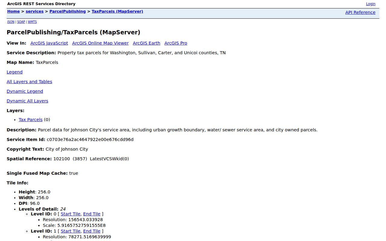
Its Johnson City owner and parcel fields help trace the surrounding lots, but they do not prove who currently occupies them.
Johnson City Parcel Detail Fields
The TaxParcels layer has more context than a street label. Research identified owner and owner-two fields, Jan. 1 owner fields, street number and street, address, map and group, GIS link, tax year, acreage, jurisdiction, zoning, subdivision, and utility-service fields. The Site Address Points layer adds municipality, school, fire, police, code, floodplain, historic, and overlay-zone information. Those layers help determine which public office may have a related record.
| GISLINK or parcel ID | Connects the selected map feature to property research |
|---|---|
| Owner and Jan. 1 owner | Identifies tax-roll ownership fields, not a complete resident list |
| Address and municipality | Separates the site address from postal or service labels |
| Jurisdiction and zones | Points toward the city, county, planning, or service context |
A GIS map result can be a powerful index to records, but its service-area coverage is broader than Johnson City’s incorporated limits.
Johnson City Block Custodians
Johnson City is the search location, but many county records are kept in Jonesborough. The Washington County Register of Deeds, Assessor, Clerk and Master, and archives route land, probate, and historical records through county offices. Johnson City handles its own permit, planning, code, and property-review functions through CityView. The city’s public parcel service also crosses four counties. A block can therefore involve a city portal, the county property roll, and a different county office before a record can be confirmed.
Before requesting a copy, read the municipality and jurisdiction fields, then compare the city-limits layer with the parcel. The register or assessor may be the right custodian even when a mailing address says Johnson City. For a longer named-street trail, the Johnson City by-street directory keeps the focus on the full street rather than the immediate block.
Johnson City Labels Need Checking
A Johnson City postal label does not settle city jurisdiction. The city-limits layer is updated after annexations and deannexations, while the parcel ecosystem serves several counties. A nearby parcel can have a Johnson City delivery label yet lie outside the current city limits. The reverse can also happen when a city parcel has a ZIP whose postal label is not a legal municipality.
Check three items before drawing a boundary conclusion: the site-address municipality, the CityLimits layer, and the USPS result for the exact address. This is also why an owner mailing ZIP is only a contact clue. It may lead outside the parcel, city, or county.
Johnson City Neighborhood Contacts
Johnson City community organizations can provide public board contacts, maps, meeting information, or governing documents, but their household directories are not open block records. The downtown revitalization plan identifies Watauga and Unaka Avenues, East Davis, Langston and Hinkle, Highland Park, and Tree Streets as surrounding neighborhoods. Those names are useful geographic search terms for historical material, not proof of membership or residence.
| Community Source | Public Material Identified | Private Boundary |
|---|---|---|
| Shadowood HOA | Board names, meeting material, restrictions, complaint form, and dues information | Membership directory is referenced but not public |
| Chestnut Cove HOA | Governing documents, permits, applications, dues, and contact route | Resident directory is portal-only |
| Downtown Johnson City and related district bodies | District maps, agendas, budgets, and downtown information | No general resident list |
The downtown revitalization plan supplies the named neighborhood geography. Use an organization’s own public contact route for coordination rather than trying to obtain a private member list.
Neighbors and Voter Record Limits
GoVoteTN can use a person’s name and ZIP or a street address and ZIP to return voter-specific information such as polling location and district. It is not a tool for identifying every neighbor on a block. The separate Tennessee registration lookup also requires county, first name, last name, birth month, and birth year. These interfaces are designed for a supplied individual, not a neighborhood roster.
Tennessee makes permanent registration records public for inspection under T.C.A. § 2-2-127 with sensitive identifiers withheld. A full voter file has political-purpose certification rules, and the exact Washington County request form and fee were not located in the research. Ask the Election Commission for its current procedure instead of assuming a casual map search exposes a block list.
Johnson City Permit Leads
CityView can add a dated property layer after the parcel map identifies an address. Its public permit locator accepts an application number, address, parcel number, or permit-contact name or address through an autocomplete search. The property locator accepts a street address or parcel number. A Property Review may show parcel number, legal description, current and historic owner contacts, address rows, zone, planning items, permit applications, and status. A permit result can identify an application number, work class, date issued, description, address, owner or contact, and status.
Use those fields to learn which city file may be relevant, not to identify every neighbor. A multi-address parcel can have several units or address rows, and a permit contact may be an owner, contractor, or other project contact. The public research did not locate a CityView coverage start year, and the portal says documents may be reproduced only with the expressed consent of the author or originator. A status row does not resolve ownership or occupancy. Compare it with the parcel, tax year, and recorded instrument before attaching it to a block history.
The portal displayed an email-scam alert during research. Open Johnson City CityView directly or use the city’s listed assistance numbers, rather than following an unexpected payment message. When a record is not indexed, ask the city records custodian for the existing permit, planning, or code material by address and date.
Johnson City Neighbor Privacy Limits
Parcel records can identify legal ownership, a mailing clue, and property characteristics. They do not list renters, guests, adult children, or every household member. Utility and delivery records are not general public resident indexes. DMV personal information is restricted by federal law. Safe at Home participants and protected voters can have special address handling. No map gap should be treated as evidence that a person is absent.
Use official records for personal neighborhood curiosity, property history, or civic context. If an error appears, contact the actual custodian, such as the assessor, GIS office, election commission, or Register of Deeds. Do not use a block search to watch, contact, threaten, or pressure another person.